Fig. 1
From: Three-dimensional topology dataset of folded radar stratigraphy in northern Greenland

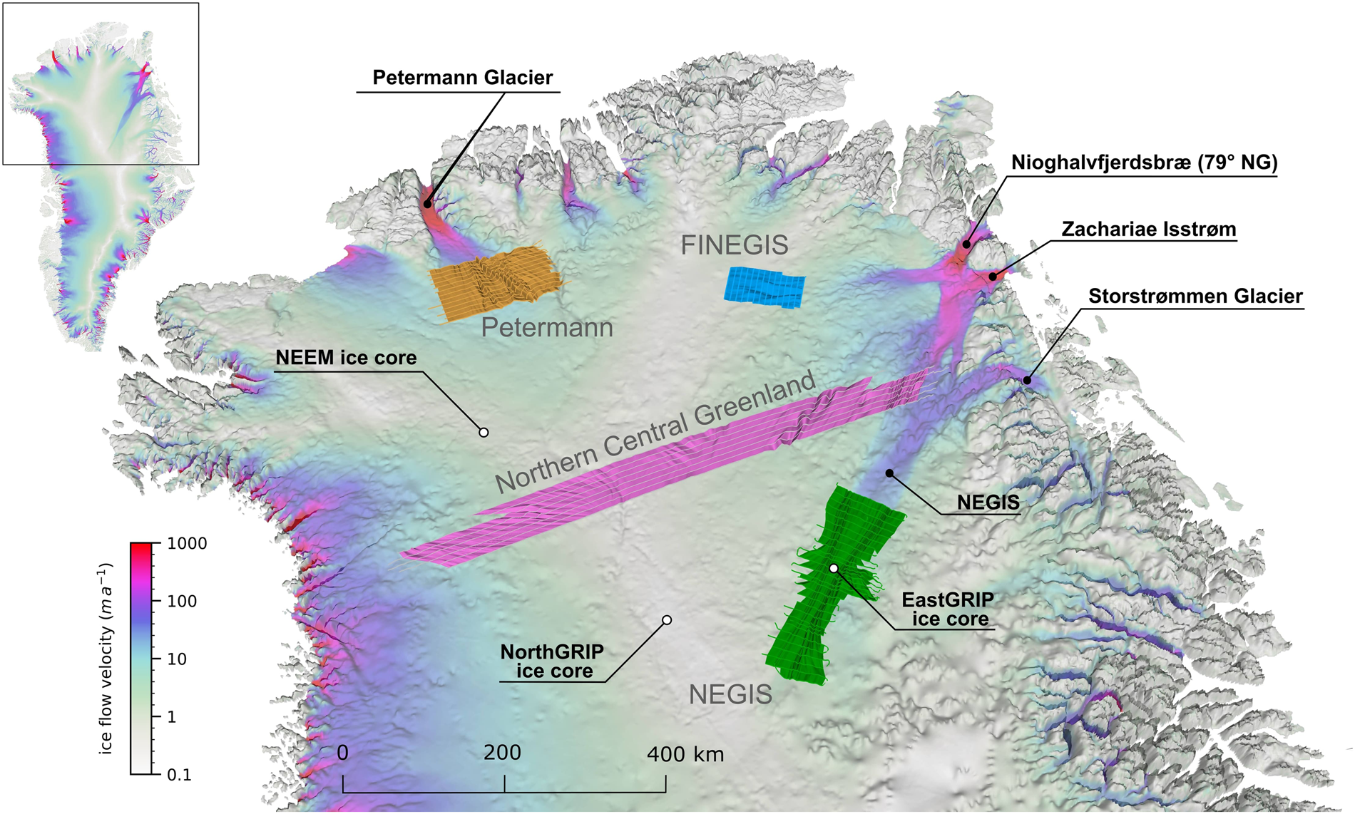
Overview of the locations of the four data sets of 3D englacial stratigraphy horizons in northern Greenland: Petermann (orange), FINEGIS (Folds in the Northeast Greenland ice sheet; blue), NEGIS (Northeast Greenland Ice Stream onset; green) and Northern Central Greenland (violet). The base map shows the bed topography47 overlain with a colour map of the ice surface velocity85 of Greenland. The map has a vertical exaggeration of 15, and the ice surface velocity is shown on a logarithmic scale.
