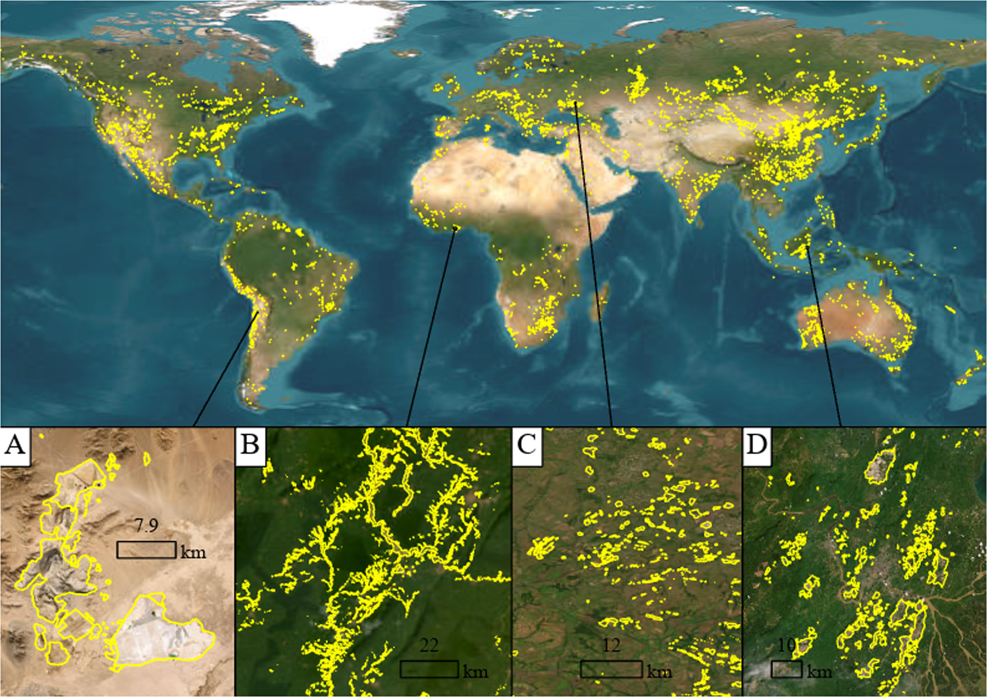
Fig. 1: Global mine area coverage, with cases of delineation of representative mine sites shown.
From: Global mining footprint mapped from high-resolution satellite imagery

A Larger open pit operations (Escondida mine, copper porphyry deposit, Chile, 24°16’15 S, 69°4’14 W); B Formal/artisanal placer gold mining, Ankobra River, Ghana, where all mining sites are along the riversides or in the riverbed, forming a dendritic configuration (5°43’ N, 2°6’ W). C Coal mine sites and gangue heaps in Donetsk, Ukraine (48°12’ N, 38°39’ E); D Coal mine areas surrounding Samarinda in East Kalimantan, Indonesia (0°29’48 S 117°08’10 E). Imagery credit: Esri, Maxar, and Earthstar Geographics.
